Local Government
Serpentine-Jarrahdale
Region
Peel
South Western Hwy Byford
bounded by Mead St, Gordon Way, Moore St, Soldiers Rd, & SW Hwy. 1km sth of Byford
Serpentine-Jarrahdale
Peel
| Type | Status | Date | Documents | More information |
|---|---|---|---|---|
| (no listings) |
| Type | Status | Date | Documents |
|---|---|---|---|
| (no listings) |
| Type | Status | Date | Grading/Management | More information | |
|---|---|---|---|---|---|
| Category | Description | ||||
| Classified by the National Trust | Classified {Lscpe} | 05 May 1994 |
|
Heritage Council | |
| Register of the National Estate | Permanent | 26 Oct 1999 |
|
Heritage Council | |
| Local Heritage Survey | Adopted | 19 Sep 2022 | Category 3 |
Category 3 |
|
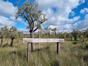
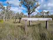
Brickwood reserve comprises of an area approximately 50ha south of Mead Street and bounded by Soldiers and Turner Roads.
Brickwood reserve was named after G.C. Brickwood, a Councillor for the Shire of Serpentine
Jarrahdale 1967 - 1977.
| Ref Number | Description |
|---|---|
| SJ1-16 | Local Heritage Survey |
Landscape
| Epoch | General | Specific |
|---|---|---|
| Original Use | OTHER | Other |
| Present Use | OTHER | Other |
| General | Specific |
|---|---|
| DEMOGRAPHIC SETTLEMENT & MOBILITY | Aboriginal Occupation |
This information is provided voluntarily as a public service. The information provided is made available in good faith and is derived from sources believed to be reliable and accurate. However, the information is provided solely on the basis that readers will be responsible for making their own assessment of the matters discussed herein and are advised to verify all relevant representations, statements and information.