Local Government
Wanneroo
Region
Metropolitan
169 Gibbs Rd Nowergup
Wanneroo
Metropolitan
| Type | Status | Date | Documents |
|---|---|---|---|
| (no listings) |
| Type | Status | Date | Documents |
|---|---|---|---|
| (no listings) |
| Type | Status | Date | Grading/Management | |
|---|---|---|---|---|
| Category | ||||
| Municipal Inventory | Adopted | 26 Apr 2006 | Category 3 | |
| Library Id | Title | Medium | Year Of Publication |
|---|
Historic site
| Epoch | General | Specific |
|---|---|---|
| Original Use | INDUSTRIAL\MANUFACTURING | Other |
| General | Specific |
|---|---|
| DEMOGRAPHIC SETTLEMENT & MOBILITY | Settlements |
| OCCUPATIONS | Manufacturing & processing |
This information is provided voluntarily as a public service. The information provided is made available in good faith and is derived from sources believed to be reliable and accurate. However, the information is provided solely on the basis that readers will be responsible for making their own assessment of the matters discussed herein and are advised to verify all relevant representations, statements and information.
This site is identifiable as containing two kilns, however they can only be inspected from a distance. Brittain describes them as being four arch. The kilns can be seen to the west of Gibbs Road but on the east side of the ridge.
Correspondence between Wanneroo Road Board and the Department of Labour dated 1937 refers to a lime kiln site at the 24 mile peg operated by Dindo And Zoe. This is likely to be that site.
This information is provided voluntarily as a public service. The information provided is made available in good faith and is derived from sources believed to be reliable and accurate. However, the information is provided solely on the basis that readers will be responsible for making their own assessment of the matters discussed herein and are advised to verify all relevant representations, statements and information.
275 Gibbs Rd Nowergup
On the west side of Gibbs Rd
Wanneroo
Metropolitan
Constructed from 1860 to 1870
| Type | Status | Date | Documents |
|---|---|---|---|
| (no listings) |
| Type | Status | Date | Documents |
|---|---|---|---|
| (no listings) |
| Type | Status | Date | Grading/Management | |
|---|---|---|---|---|
| Category | ||||
| Municipal Inventory | Adopted | 26 Apr 2006 | Category 4 | |
Demolished on 28 February 2006.
Historic Site
| Epoch | General | Specific |
|---|---|---|
| Present Use | VACANT\UNUSED | Vacant\Unused |
| Original Use | RESIDENTIAL | Single storey residence |
| Type | General | Specific |
|---|---|---|
| Wall | STONE | Other Stone |
| Roof | METAL | Corrugated Iron |
| General | Specific |
|---|---|
| PEOPLE | Early settlers |
This information is provided voluntarily as a public service. The information provided is made available in good faith and is derived from sources believed to be reliable and accurate. However, the information is provided solely on the basis that readers will be responsible for making their own assessment of the matters discussed herein and are advised to verify all relevant representations, statements and information.
Constructed from 1860, Constructed from 1870
Perry House is of exceptional historic significance as an example of a rare stone homestead that probably dates from the 1860s or 70s in Wanneroo. It is of aesthetic significance as an example of a rural homestead in a picturesque setting. It is of historic and social significance for associations with the Perry family, early settlers in the district.
'Demolished by owner on 28 Feb 2006 during Ml review process* Perry House is located at Lot 1831, 275 Gibbs Road, Nowergup on a rural property on the west side of Gibbs Road within the City of Wanneroo's North Ward. The house is oriented north-south on land which rises behind and towards the west. There is a more recent house west of Perry House. The mainly cleared site has mature trees and is fenced with timber post and wire mesh fencing. There is a driveway to the south side of the house. The single storey rendered house is constructed of stone. It sits at ground level and has as steeply pitched corrugated iron gabled roof which extends over the verandahs on the north and south sides. The original roof may have been shingled however physical inspection is required to verify this. There is a shed to the north of Perry House. An internal inspection has not been undertaken.
The suburb of Nowergup takes its name from Lake Nowergup. The lake name was first recorded by Surveyor General J.S. Roe in 1841, and is an Aboriginal word that possibly means 'place of sweet water'. It was adopted as a suburb name in 1982. Based on historical information, it is likely that the house at 275 Gibbs Road was built in the 1860s or 70s. (Further research is however required to confirm this) This property is believed to have been owned by William Thomas Perry, who was the older brother of Joseph Perry, who owned the Limekilns Estate (Perry Lakes) purchased by the City of Perth in 1917. William Perry was listed in the Post Office Directories in 1903 as a gardener in Wanneroo. William's eldest son James died on the property in 1910 aged 40 years, while kangaroo shooting. The property was used for picnic type race meetings in the 1920s-1930s. Note: William Perry is noted as the older brother of Joe Perry of Perry Lakes. Joe Perry was the father of John Perry (1971 to 1929) who owned Perry's Paddock from 1912. Therefore it seems likely that William Perry of 275 Gibbs Road was probably John Perry's uncle.
Site
This information is provided voluntarily as a public service. The information provided is made available in good faith and is derived from sources believed to be reliable and accurate. However, the information is provided solely on the basis that readers will be responsible for making their own assessment of the matters discussed herein and are advised to verify all relevant representations, statements and information.
465 Gibbs Rd Nowergup
This is a semi rural property west of Gibbs Road and east of Nowergup Lake. The house is setback and not visible from the road.
Wanneroo
Metropolitan
| Type | Status | Date | Documents |
|---|---|---|---|
| Heritage List | Adopted | 07 Nov 2016 |
| Type | Status | Date | Documents |
|---|---|---|---|
| (no listings) |
| Type | Status | Date | Grading/Management | |
|---|---|---|---|---|
| Category | ||||
| Municipal Inventory | Adopted | 26 Apr 2006 | Category 3 | |
Individual Building or Group
| Epoch | General | Specific |
|---|---|---|
| Original Use | RESIDENTIAL | Single storey residence |
| Type | General | Specific |
|---|---|---|
| Other | TIMBER | Other Timber |
| Other | TIMBER | Tongue & Groove |
| Roof | METAL | Corrugated Iron |
| General | Specific |
|---|---|
| DEMOGRAPHIC SETTLEMENT & MOBILITY | Land allocation & subdivision |
This information is provided voluntarily as a public service. The information provided is made available in good faith and is derived from sources believed to be reliable and accurate. However, the information is provided solely on the basis that readers will be responsible for making their own assessment of the matters discussed herein and are advised to verify all relevant representations, statements and information.
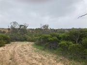
The house at 465 Gibbs Road is historically and aesthetically significant as a rare example of a bush shack in a picturesque rural setting in the Wanneroo area.
The house is located on Lot 10 D 65558 Vol 2124 Folio 721, house number 465 Gibbs Road, Nowergup. This is a semi rural property west of Gibbs Road and east of Nowergup Lake within the City of Wanneroo's North Ward. The house is setback and not visible from the road and is approached via a dirt track. The gently undulating site is partially cleared and also has many established trees including Eucalypts. Fencing includes timber bush poles with wire and, fronting the cottage, is a bush pole timber post and rail fence with an iron gate. The house comprises a single room with a gabled roofed and is constructed of bush poles clad with timber tongued and grooved boarding to the upper front fagade and remnants of corrugated iron to the remaining walls and roof (possibly reused kerosene cans or drums). The cottage is unlined with door and window openings and remnants of a timber tongued and a grooved floor. The verandah is supported by bush poles. On the east side of the cottage is the remnants of a shed structure also constructed with bush poles and clad with and corrugated iron to the walls and skillion roof. There is an abandoned car adjacent.
The suburb of Nowergup takes its name from Lake Nowergup. The lake name was first recorded by Surveyor General J.S. Roe in 1841, and is an Aboriginal word which possibly means 'place of sweet water'. It was approved as a suburb name in 1982. The house was possibly built by Emie Chitty when he ran cattle on the property (City of Wanneroo - 15th October 2004 Comments on draft Ml)
This information is provided voluntarily as a public service. The information provided is made available in good faith and is derived from sources believed to be reliable and accurate. However, the information is provided solely on the basis that readers will be responsible for making their own assessment of the matters discussed herein and are advised to verify all relevant representations, statements and information.
6 Gibbs Rd Nowergup
Wanneroo
Metropolitan
Constructed from 1903
| Type | Status | Date | Documents |
|---|---|---|---|
| Heritage List | Adopted | 07 Nov 2016 |
| Type | Status | Date | Documents |
|---|---|---|---|
| (no listings) |
| Type | Status | Date | Grading/Management | |
|---|---|---|---|---|
| Category | ||||
| Municipal Inventory | Adopted | 25 May 1994 | Category 3 | |
Very Good
| Library Id | Title | Medium | Year Of Publication |
|---|---|---|---|
| 8708 | Alkimos Eglinton district structure plan. | Book | 2007 |
Individual Building or Group
| Epoch | General | Specific |
|---|---|---|
| Present Use | RESIDENTIAL | Single storey residence |
| Original Use | RESIDENTIAL | Single storey residence |
| Type | General | Specific |
|---|---|---|
| Wall | STONE | Limestone |
| Roof | METAL | Corrugated Iron |
| Other | TIMBER | Weatherboard |
| Other | ASBESTOS | Fibrous Cement, corrugated |
This information is provided voluntarily as a public service. The information provided is made available in good faith and is derived from sources believed to be reliable and accurate. However, the information is provided solely on the basis that readers will be responsible for making their own assessment of the matters discussed herein and are advised to verify all relevant representations, statements and information.
Constructed from 1903
Aesthetic significance as an example of a modest limestone cottage dating from the early 20th century. Historic significance for association with George Leach and his family who farmed the area from the 1890s. Social significance for its contribution to the community's sense of place.
Single storey limestone cottage with symmetrical facade. Iron roof with twin gables to front and framed gable over roof plate to side elevations. Brick quioning to door and window openings. Bullnosed verandah not original. Brick additions to rear not original.
Charles Leach farmed the area since 1890's; owner of first automobile and a Road Board Member.
This information is provided voluntarily as a public service. The information provided is made available in good faith and is derived from sources believed to be reliable and accurate. However, the information is provided solely on the basis that readers will be responsible for making their own assessment of the matters discussed herein and are advised to verify all relevant representations, statements and information.
6 Gibbs Rd Nowergup
Access via Wattle Ave
Wanneroo
Metropolitan
| Type | Status | Date | Documents |
|---|---|---|---|
| (no listings) |
| Type | Status | Date | Documents |
|---|---|---|---|
| (no listings) |
| Type | Status | Date | Grading/Management | |
|---|---|---|---|---|
| Category | ||||
| Municipal Inventory | Adopted | 25 May 1994 | Category 3 | |
good
| Library Id | Title | Medium | Year Of Publication |
|---|---|---|---|
| 8708 | Alkimos Eglinton district structure plan. | Book | 2007 |
Individual Building or Group
| Epoch | General | Specific |
|---|---|---|
| Present Use | RESIDENTIAL | Single storey residence |
| Original Use | RESIDENTIAL | Single storey residence |
| Type | General | Specific |
|---|---|---|
| Wall | STONE | Limestone |
| Wall | TIMBER | Other Timber |
| General | Specific |
|---|---|
| DEMOGRAPHIC SETTLEMENT & MOBILITY | Settlements |
| OCCUPATIONS | Rural industry & market gardening |
This information is provided voluntarily as a public service. The information provided is made available in good faith and is derived from sources believed to be reliable and accurate. However, the information is provided solely on the basis that readers will be responsible for making their own assessment of the matters discussed herein and are advised to verify all relevant representations, statements and information.
Aesthetic significance as an example of timber framed house constructed in the Wanneroo area in the Inter-War years. Historic significance for its association with the Leach family. Social significance for its contribution to the community's sense of place.
Single storey timber framed substantial home built on slope of hill. Weatherboard to sill height, battened asbestos above. Hipped, iron roof with projecting double gable to front. Timber posts to front verandah and detailed timber joinery to windows. Terracotta pots to tall chimney.
Leach family constructed a more substantial home to accommodate a growing family. Economic conditions during the Depression years may have precluded the use of stone.
Good
This information is provided voluntarily as a public service. The information provided is made available in good faith and is derived from sources believed to be reliable and accurate. However, the information is provided solely on the basis that readers will be responsible for making their own assessment of the matters discussed herein and are advised to verify all relevant representations, statements and information.
99 Gibbs Rd Nowergup
On the west side of Gibbs Road.
Wanneroo
Metropolitan
Constructed from 1929
| Type | Status | Date | Documents |
|---|---|---|---|
| Heritage List | Adopted | 07 Nov 2016 |
| Type | Status | Date | Documents |
|---|---|---|---|
| (no listings) |
| Type | Status | Date | Grading/Management | |
|---|---|---|---|---|
| Category | ||||
| Municipal Inventory | Adopted | 25 May 1994 | Category 2 | |
Very Good
Individual Building or Group
| Epoch | General | Specific |
|---|---|---|
| Original Use | FARMING\PASTORAL | Homestead |
| Present Use | FARMING\PASTORAL | Homestead |
| Type | General | Specific |
|---|---|---|
| Other | TIMBER | Other Timber |
| Roof | METAL | Corrugated Iron |
| Wall | RENDER | Cement Dressed |
| Wall | STONE | Limestone |
| General | Specific |
|---|---|
| OCCUPATIONS | Rural industry & market gardening |
| DEMOGRAPHIC SETTLEMENT & MOBILITY | Settlements |
This information is provided voluntarily as a public service. The information provided is made available in good faith and is derived from sources believed to be reliable and accurate. However, the information is provided solely on the basis that readers will be responsible for making their own assessment of the matters discussed herein and are advised to verify all relevant representations, statements and information.
Constructed from 1929
Gibbs House is aesthetically significant as a good example of the City of Wanneroo's vernacular architecture dating from the Inter-War period. A typical single storey homestead dating from the first decades of the twentieth century. It is a historically significant as a representation of the establishment of farming in the Wanneroo district and for its associations with the Gibbs family who were early settlers in the district.
Jabez Gibbs House is located at Lot 1536, 99 Gibbs Road, Nowergup on a rural property on the west side of Gibbs Road within the City of Wanneroo's North Ward. The house faces east on land which rises towards the west. The cleared site has established trees including Eucalypts and a fence constructed of timber posts with wire mesh. There is a driveway to the south side of the house. The house is single storey rendered stone with a steeply pitched corrugated iron roof. The roof which has a brick chimney is hipped and has a gable on the south side which is lined with fibrous cement sheets. The verandah has a concrete floor, returns on at least three sides of the house and is supported by timber posts. There are some timber sash windows extant and some windows and doors which appear to have been altered.
The suburb of Nowergup takes its name from Lake Nowergup. The lake name was first recorded by Surveyor General J. S. Roe in 1841, and is an Aboriginal word which possibly means 'place of sweet water". It was approved as a suburb name in 1982. William Lacey Gibbs (father of Jabez Gibbs) first took up 100 acres of land in Pipidinny Wanneroo in 1884. In 1919 Jabez and Florence Gibbs and their three sons, Jabez (Ned), William and Lacey moved to Wanneroo. In 1923 the Gibbs family bought 40 acres at the 23 Mile peg, now known as 99 Gibbs Road. The Gibbs family grew to nine children, two of whom died as prisoners of war in WWII. The Gibbs' reclaimed surrounding swamplands, ran cattle and had a market garden growing mainly tomatoes on the property. The existing house was built by a stone mason in 1929 replacing the original hessian covered hut. The house was constructed from local limestone and had eight rooms surrounded by verandahs. Jabez Gibbs donated the land which became Gibbs Road. Ned Gibbs, who served on the Wanneroo Road Board, was awarded a Shire plaque in 1982 in recognition of 50 years of continuous living in the Wanneroo district since turning 21. Together with his brother Albert Gibbs, Ned later bred trotters which were trained on the property until the 1980s. Ned died in 2003.
Very Good
This information is provided voluntarily as a public service. The information provided is made available in good faith and is derived from sources believed to be reliable and accurate. However, the information is provided solely on the basis that readers will be responsible for making their own assessment of the matters discussed herein and are advised to verify all relevant representations, statements and information.
90 Nowergup Rd Nowergup
Wanneroo
Metropolitan
| Type | Status | Date | Documents |
|---|---|---|---|
| Heritage List | Adopted | 07 Nov 2016 |
| Type | Status | Date | Documents |
|---|---|---|---|
| RHP - To be assessed | Current | 28 Sep 2007 |
| Type | Status | Date | Grading/Management | |
|---|---|---|---|---|
| Category | ||||
| Municipal Inventory | Adopted | 25 May 1994 | Category 1 | |
18338 Lime Kilns, Wanneroo
Good
| Library Id | Title | Medium | Year Of Publication |
|---|
Historic site
| Epoch | General | Specific |
|---|---|---|
| Original Use | INDUSTRIAL\MANUFACTURING | Other |
| Present Use | INDUSTRIAL\MANUFACTURING | Other |
| Type | General | Specific |
|---|---|---|
| Wall | BRICK | Common Brick |
| Wall | STONE | Limestone |
| General | Specific |
|---|---|
| OCCUPATIONS | Manufacturing & processing |
| DEMOGRAPHIC SETTLEMENT & MOBILITY | Settlements |
This information is provided voluntarily as a public service. The information provided is made available in good faith and is derived from sources believed to be reliable and accurate. However, the information is provided solely on the basis that readers will be responsible for making their own assessment of the matters discussed herein and are advised to verify all relevant representations, statements and information.
Very high significance due to the quantity and variety of kilns, the largest such kiln site in the district. It is also significant as a site that resumed operations after the extensive buy-out of smaller operators in the 1960s.
This is a collection of kilns, including the unusual bottle kiln. The site is now disused but includes a quarry. Kiln 28, 30 and 31 are single three-arch, kiln 29 a two-arch and kilns 42 and 46 bottle kilns.
The first operation of the kilns was between the mid 1930s and c1950. In the late 1960s the site was amongst many in the area purchased by Swan Portland Cement Company. However unlike the other sites, some of the kilns here were returned to service in the late 1980s when Menchetti took over the site to supply lime.
Good
| Owner | Category |
|---|---|
| Lime Kilns Parks Pty Ltd | Other Private |
This information is provided voluntarily as a public service. The information provided is made available in good faith and is derived from sources believed to be reliable and accurate. However, the information is provided solely on the basis that readers will be responsible for making their own assessment of the matters discussed herein and are advised to verify all relevant representations, statements and information.
2500 Wanneroo Rd Nowergup
Wanneroo
Metropolitan
| Type | Status | Date | Documents |
|---|---|---|---|
| (no listings) |
| Type | Status | Date | Documents |
|---|---|---|---|
| (no listings) |
| Type | Status | Date | Grading/Management | |
|---|---|---|---|---|
| Category | ||||
| Register of the National Estate | Registered | 21 Mar 1978 | ||
| Municipal Inventory | Adopted | 25 May 1994 | Category 4 | |
Landscape
| Epoch | General | Specific |
|---|---|---|
| PARK\RESERVE | Park\Reserve |
| General | Specific |
|---|---|
| SOCIAL & CIVIC ACTIVITIES | Environmental awareness |
This information is provided voluntarily as a public service. The information provided is made available in good faith and is derived from sources believed to be reliable and accurate. However, the information is provided solely on the basis that readers will be responsible for making their own assessment of the matters discussed herein and are advised to verify all relevant representations, statements and information.
Lake area and surrounds provide suitable habitat for diverse populations of water birds. Western part of lake fringed with jointed twig rush, bulrushes occur around northern shore. Bordering sedgeland is a woodland of flooded gum and swamp banksia. There is some low open forest of swamp paperbark. It is a natural and modified environment. The area is returning to its natural state after clearing and a weed invasion.
Site
This information is provided voluntarily as a public service. The information provided is made available in good faith and is derived from sources believed to be reliable and accurate. However, the information is provided solely on the basis that readers will be responsible for making their own assessment of the matters discussed herein and are advised to verify all relevant representations, statements and information.
27 Perry Rd Pinjar
Iopollo House
Sinagra House
Wanneroo
Metropolitan
| Type | Status | Date | Documents |
|---|---|---|---|
| (no listings) |
| Type | Status | Date | Documents |
|---|---|---|---|
| (no listings) |
| Type | Status | Date | Grading/Management | |
|---|---|---|---|---|
| Category | ||||
| Municipal Inventory | Adopted | 26 Apr 2006 | Category 3 | |
At the time of inspection in 2004 (for the MHI) the place was in a deteriorated condition. The door and window openings do not appear to have doors and windows extant and there is cgi sheetig missing from the roof.
Individual Building or Group
| Epoch | General | Specific |
|---|---|---|
| Original Use | RESIDENTIAL | Single storey residence |
| Present Use | RESIDENTIAL | Single storey residence |
| Type | General | Specific |
|---|---|---|
| Other | METAL | Corrugated Iron |
| Wall | OTHER | Other Material |
| Other | BRICK | Common Brick |
| Other | STONE | Limestone |
| General | Specific |
|---|---|
| OCCUPATIONS | Commercial & service industries |
| DEMOGRAPHIC SETTLEMENT & MOBILITY | Settlements |
| OCCUPATIONS | Grazing, pastoralism & dairying |
This information is provided voluntarily as a public service. The information provided is made available in good faith and is derived from sources believed to be reliable and accurate. However, the information is provided solely on the basis that readers will be responsible for making their own assessment of the matters discussed herein and are advised to verify all relevant representations, statements and information.
Albert Thomas House is aesthetically significant as an example of the City of Wanneroo's vernacular architecture. It is a typical single storey homestead dating from the Inter-War period. Historically the place is significant as a representation of the establishing of farming in the Wanneroo district and for its associations with the Sinagra family who were settlers in the Wanneroo district in the Inter-War period.
Albert Thomas House which is currently vacant (2004) is located at Pt Lot 2928, 27 Perry Road, Pinjar in a rural property on the north side of Perry Road within the City of Wanneroo's North Ward. The house is setback approximately 150 metres from the road and faces west on the land which rises gently towards the north. The mostly cleared site also contains a concrete tank and shed on the south side of the house, a bread oven on the east side and established trees including olive trees and a fence of timber bush poles with wire mesh. The single storey homestead is built from concrete blocks on limestone footings and has a steeply pitched corrugated iron hipped roof with a brick chimney. The verandah which is incorporated under the roof, surrounds the four sides of the house and is supported by timber posts. The door and window openings do not appear to have doors and windows extant and there is cgi sheeting missing from the roof. At the time on inspection in 2004 the place was in a deteriorated condition.
The suburb of Pinjar is named after the large swampy lake of this name located north east of Wanneroo. The lake name is shown on government plans from 1868, and the name is of Aboriginal origin. The meaning of Pinjar is unknown, but could be 'tadpole' or 'swampy lake'. The Sinagra's arrived from Italy in 1923 and raised eight sons and three daughters in Wanneroo. They purchased the property at Perry Road Pinjar in 1931 which had been a diary since the 1920s for market gardening and grazing cattle. The cottage was built from hand made cement blocks by a cartage contractor who was part-time secretary of the Shire of Wanneroo
This information is provided voluntarily as a public service. The information provided is made available in good faith and is derived from sources believed to be reliable and accurate. However, the information is provided solely on the basis that readers will be responsible for making their own assessment of the matters discussed herein and are advised to verify all relevant representations, statements and information.
68 Ocean Dr Quinns Rocks
Wanneroo
Metropolitan
Constructed from 1955
| Type | Status | Date | Documents |
|---|---|---|---|
| (no listings) |
| Type | Status | Date | Documents |
|---|---|---|---|
| (no listings) |
| Type | Status | Date | Grading/Management | |
|---|---|---|---|---|
| Category | ||||
| Municipal Inventory | Adopted | 26 Apr 2006 | Category 3 | |
| Library Id | Title | Medium | Year Of Publication |
|---|
Individual Building or Group
| Epoch | General | Specific |
|---|---|---|
| Original Use | RESIDENTIAL | Single storey residence |
| Present Use | RESIDENTIAL | Single storey residence |
| Type | General | Specific |
|---|---|---|
| Wall | TIMBER | Other Timber |
| Wall | ASBESTOS | Fibrous Cement, weatherboard |
| Roof | ASBESTOS | Fibrous Cement, corrugated |
| General | Specific |
|---|---|
| DEMOGRAPHIC SETTLEMENT & MOBILITY | Settlements |
This information is provided voluntarily as a public service. The information provided is made available in good faith and is derived from sources believed to be reliable and accurate. However, the information is provided solely on the basis that readers will be responsible for making their own assessment of the matters discussed herein and are advised to verify all relevant representations, statements and information.
Constructed from 1955
Quinns Beach House and Shack, 68 Ocean Drive has historic significance as an intact example of a prefabricated house typical of those constructed in the Wanneroo area during the 1950s and 1960s. The shack has historic significance representing basic accommodation used by fishermen in the district.
The house and shack are located at Lot 113, 68 Ocean Drive, Quinns Rocks. The lot is situated on the eastern side of Ocean Drive on the beachfront with expansive views of the coastline within the City of Wanneroo's Coastal Ward. The house faces west and is setback approximately 60 metres from the road and the shed is located at the rear of the property. The single storey timber framed fibrous cement clad house is set on limestone foundations and has a corrugated asbestos clad slightly pitched skillion roof. The entrance comprises a pair of timber framed glazed doors which have side and top windows and open onto a concrete floored verandah. Internally the house is substantially intact and comprises a living area, kitchen, two bedrooms, bathroom and laundry. The hallway features timber panelling and the original fittings in the kitchen and bathroom are extant. The timber framed shack situated at the rear of the house is clad with weatherboards and fibrous cement flat sheets. Some modifications have been made to the former fisherman's shack.
The suburb of Quinns Rocks probably takes its name from the offshore reef first noted during a coastline survey by Surveyor James Cowle in 1867. Although spelt with a double 'n', the rocks are thought to have been named after Robert Quin who emigrated to Western Australia in 1863, and was appointed as an Assistant Surveyor on his arrival. Quin died in July 1886. The general area of the coast opposite the rocks was referred to as Quinns Rocks by the Wanneroo Road Board when they requested the survey of a road to that place in November 1925. Later the place also came tp be called 'Wanneroo Beach'. Quinns Rocks was declared a townsite in 1962. The house at 68 Ocean Drive was erected in 1955 by Alco from an Alco Pre-cut Holiday Home package as a demonstration home and was made by the Australian Lumber Co Pty Ltd Melville WA. Subsequently, a number of similar houses were also erected in the area. The property is currently (2004) owned by the original owner, David Watkins. Mr Watkins re-located his former fishing shack in the 1950s from Marmion to the rear of the site/house to be converted into a shed. Note: Fishing shacks had been built on a narrow strip of Reserve land vested for public use. During the 1950s the owners were ordered under an amended Land Act to remove their structures. To provide alternative sites the Town Planning Department approved the subdivision of 100 lots. Some of the people who had fishing shacks near the beachfront purchased some of these blocks and a few of the fishing shacks were relocated and converted into garages. BA59/0314 (D Watkins) and wrokshop BA60/0451
This information is provided voluntarily as a public service. The information provided is made available in good faith and is derived from sources believed to be reliable and accurate. However, the information is provided solely on the basis that readers will be responsible for making their own assessment of the matters discussed herein and are advised to verify all relevant representations, statements and information.
990 Wanneroo Rd Sinagra
St Anthony's Church
St Anthony's School
Wanneroo
Metropolitan
Constructed from 1932, Constructed from 1953
| Type | Status | Date | Documents |
|---|---|---|---|
| (no listings) |
| Type | Status | Date | Documents |
|---|---|---|---|
| RHP - Assessed - Below Threshold | Current | 23 Feb 2007 |
| Type | Status | Date | Grading/Management | |
|---|---|---|---|---|
| Category | ||||
| Catholic Church Inventory | Adopted | 01 Jul 1998 | ||
| Municipal Inventory | Adopted | 25 May 1994 | Category 1 | |
| Municipal Inventory | Adopted | 25 May 1994 | Category 1 | |
FAIR - due to non use of the building and subsequent vandalism and graffiti.
| Name | Type | Year From | Year To |
|---|---|---|---|
| E. Le. B. Henderson | Architect | - | - |
| Library Id | Title | Medium | Year Of Publication |
|---|---|---|---|
| 7371 | St Anthony's Church Wanneroo (1932) : statement of significance. | Heritage Study {Other} | 1997 |
Individual Building or Group
| Epoch | General | Specific |
|---|---|---|
| Present Use | VACANT\UNUSED | Vacant\Unused |
| Original Use | RELIGIOUS | Church, Cathedral or Chapel |
| Style |
|---|
| Inter-War Gothic |
| Type | General | Specific |
|---|---|---|
| Roof | METAL | Corrugated Iron |
| Wall | GLASS | Glass |
| Wall | STONE | Limestone |
| General | Specific |
|---|---|
| DEMOGRAPHIC SETTLEMENT & MOBILITY | Depression & boom |
| SOCIAL & CIVIC ACTIVITIES | Education & science |
| PEOPLE | Local heroes & battlers |
| SOCIAL & CIVIC ACTIVITIES | Religion |
| DEMOGRAPHIC SETTLEMENT & MOBILITY | Settlements |
| DEMOGRAPHIC SETTLEMENT & MOBILITY | Immigration, emigration & refugees |
This information is provided voluntarily as a public service. The information provided is made available in good faith and is derived from sources believed to be reliable and accurate. However, the information is provided solely on the basis that readers will be responsible for making their own assessment of the matters discussed herein and are advised to verify all relevant representations, statements and information.
Constructed from 1953, Constructed from 1932
Historic significance as the first church built in Wanneroo. Contributes to the community's sense of place and is highly valued for its religious associations.
Rendered masonry and iron church hall with external butress. Front facade comprises rendered masonry and open concrete blocks. Classrooms to the rear probably date from the time of original construction.
St Anthony's Church was the first church constructed in Wanneroo. It was opened in July 1932, after a blessing by His Grace, Archbishop Clune. It drew together various Wanneroo Committee with sermons in English, Italian and Slavonic. Additions to the original church were carried out in the 1950s.
Fair
| Name | Type | Year From | Year To |
|---|---|---|---|
| E. Le. B. Henderson | Architect | 1932 | - |
| Owner | Category |
|---|---|
| Roman Catholic Church | Church Property |
This information is provided voluntarily as a public service. The information provided is made available in good faith and is derived from sources believed to be reliable and accurate. However, the information is provided solely on the basis that readers will be responsible for making their own assessment of the matters discussed herein and are advised to verify all relevant representations, statements and information.
990 Wanneroo Rd Singara
Wanneroo
Metropolitan
| Type | Status | Date | Documents |
|---|---|---|---|
| (no listings) |
| Type | Status | Date | Documents |
|---|---|---|---|
| (no listings) |
| Type | Status | Date | Grading/Management | |
|---|---|---|---|---|
| Category | ||||
| Municipal Inventory | Adopted | 26 Apr 2006 | Category 3 | |
09498 St Anthony's Catholic Church (fmr)
Individual Building or Group
| Epoch | General | Specific |
|---|---|---|
| Original Use | RELIGIOUS | Housing or Quarters |
| Style |
|---|
| Inter-War Mediterranean |
| General | Specific |
|---|---|
| SOCIAL & CIVIC ACTIVITIES | Religion |
This information is provided voluntarily as a public service. The information provided is made available in good faith and is derived from sources believed to be reliable and accurate. However, the information is provided solely on the basis that readers will be responsible for making their own assessment of the matters discussed herein and are advised to verify all relevant representations, statements and information.
Aesthetic significance as an example of residence with elements of the Inter-War Mediterranaen style of architecture. Historic significance for its association with st Anthony's Church and for its continuous use for religious purposes. Social significance for reasons of its continuing religious associations and for its contribution to the community's sense of place.
Single Storey red brick residence with symetrical facade and entry portico. Two sets of timber framed windows with three panes and concrete lintels to either side of entry. Hipped roof with terracotta roof tiles.
Built as accomodation associated with St Anthony's Church.
| Owner | Category |
|---|---|
| Roman Catholic Church | Church Property |
This information is provided voluntarily as a public service. The information provided is made available in good faith and is derived from sources believed to be reliable and accurate. However, the information is provided solely on the basis that readers will be responsible for making their own assessment of the matters discussed herein and are advised to verify all relevant representations, statements and information.
Star Swamp to Walkaway
The entire route ran from Star Swamp to Walkaway. The place has been mapped based on information from plans showing the originally gazetted stock route in the 1890's, and the current cadastre. The curtilage also includes relevant reserves set aside along the route for watering stock and resting.
Champion Bay Stock Route
Old North Rd
Old North Stock Route
Wanneroo
Metropolitan
| Type | Status | Date | Documents |
|---|---|---|---|
| (no listings) |
| Type | Status | Date | Documents |
|---|---|---|---|
| RHP - Assessed - Consultation (Statutory) | Current | 26 Nov 2021 | HCWebsite.Listing+ListingDocument |
| Type | Status | Date | Grading/Management | |
|---|---|---|---|---|
| Category | ||||
| (no listings) | ||||
Landscape
| Epoch | General | Specific |
|---|---|---|
| Original Use | FARMING\PASTORAL | Other |
| Present Use | OTHER | Other |
| General | Specific |
|---|---|
| DEMOGRAPHIC SETTLEMENT & MOBILITY | Aboriginal Occupation |
| OCCUPATIONS | Grazing, pastoralism & dairying |
| DEMOGRAPHIC SETTLEMENT & MOBILITY | Exploration & surveying |
| PEOPLE | Local heroes & battlers |
| TRANSPORT & COMMUNICATIONS | Droving |
This information is provided voluntarily as a public service. The information provided is made available in good faith and is derived from sources believed to be reliable and accurate. However, the information is provided solely on the basis that readers will be responsible for making their own assessment of the matters discussed herein and are advised to verify all relevant representations, statements and information.
77 Ashley Rd Tapping
Wanneroo
Metropolitan
Constructed from 1920
| Type | Status | Date | Documents |
|---|---|---|---|
| (no listings) |
| Type | Status | Date | Documents |
|---|---|---|---|
| (no listings) |
| Type | Status | Date | Grading/Management | |
|---|---|---|---|---|
| Category | ||||
| Municipal Inventory | Adopted | Category 3 | ||
Individual Building or Group
| Epoch | General | Specific |
|---|---|---|
| Original Use | RESIDENTIAL | Single storey residence |
| Type | General | Specific |
|---|---|---|
| Other | TIMBER | Other Timber |
| Roof | METAL | Corrugated Iron |
| Other | RENDER | Other Render |
| Other | CONCRETE | Concrete Slab |
| General | Specific |
|---|---|
| PEOPLE | Early settlers |
This information is provided voluntarily as a public service. The information provided is made available in good faith and is derived from sources believed to be reliable and accurate. However, the information is provided solely on the basis that readers will be responsible for making their own assessment of the matters discussed herein and are advised to verify all relevant representations, statements and information.
Constructed from 1920
Eli Ashby House has historic and social significance has an early homestead in Wanneroo lived in by the Ashby family, early pioneers of the district and for its associations for the 10th Light Horse campsite and canteen during World War II. The house has some aesthetic significance as an example of Australian rural vernacular architecture in Wanneroo in the early twentieth century, however it is not intact.
Eli Ashby House is located on Lot 25, 77Ashley Road Tapping. It is accessed from the east end of Ashley Road within the City of Wanneroo's North Ward. The homestead is situated at the east end of Tapping Road and faces west with trees and shrubs including a row of palm trees on the west side. The property was part of a market garden although it is currently being subdivided for residential development and the land cleared. The house is a single storey rendered masonry building with a corrugated iron hipped roof with a rendered chimney. There is a skillion roofed verandah which returns on the south side and is supported on timber posts and has a concrete floor. The front and western elevation have timber double hung sash windows. The rear and eastern elevation has been enclosed. Internally, the house was originally four rooms which have timber floorboards and tongue and groove boarded ceilings extant. The house has been modified internally.
The suburb of Tapping is named after an early settler family in the Wanneroo area. Mr. William Tapping arrived in 1886. His descendants Misses Molly and Dolly Tapping were long time Postmistresses in Wanneroo. The name for the suburb was approved in 1997. The house on lot 25 was probably built circa 1920. Eli Edward (Jack) Ashby was a market gardener and dairy farmer and together with his wife Edith Prangle Capom and children, including daughter Elizabeth Prangle Curtis, lived at the Ashley Road property. The army used the property during WWII as a camp for the 10th Lighthorse Brigade and the homestead became a canteen for the soldiers from the nearby army medical camp. Eli Ashby was an involved community member and a member of the Wanneroo Road Board from 1915-1949 and Chairman from 1935-1944. He was also President of the Agricultural Society for 18 years during 1930s and 1940s. Eli Ashby died in 1951. In 1984 Elizabeth Curtis (who died in 1985 at aged 86) visited the homestead and noted the verandah had been removed and the walls cement rendered.
This information is provided voluntarily as a public service. The information provided is made available in good faith and is derived from sources believed to be reliable and accurate. However, the information is provided solely on the basis that readers will be responsible for making their own assessment of the matters discussed herein and are advised to verify all relevant representations, statements and information.
Two Rocks
Wanneroo
Metropolitan
| Type | Status | Date | Documents |
|---|---|---|---|
| State Register | Registered | 28 Dec 2022 | HCWebsite.Listing+ListingDocument, HCWebsite.Listing+ListingDocument |
| Type | Status | Date | Documents |
|---|---|---|---|
| (no listings) |
| Type | Status | Date | Grading/Management | |
|---|---|---|---|---|
| Category | ||||
| (no listings) | ||||
17953 Two Rocks Marina Precinct
11(a) Importance in demonstrating the evolution or pattern of Western Australia’s history;
Sun City Precinct, Two Rocks, and particularly the Two Rocks Marina, are associated with entrepreneur Alan Bond and his campaign to challenge for the America’s Cup in the 1970s, as outlined in the 1972 Yanchep Sun City Leisure Region Master Plan prepared by Clarke Gazzard Planners Pty Ltd for Yanchep Estates Pty Ltd (subsidiary of Bond Corporation).
Sun City Precinct, Two Rocks reflects the boom-and-bust cycles common to Western Australia throughout its history, and on this occasion the wealth and affluence experienced during the late 1970s and 1980s, followed by the immediate downturn of the early 1990s.
Sun City Precinct, Two Rocks provides an example of the expansion of the northern suburbs in accordance with post-WWII town and regional planning.
The King Neptune Sculpture, the primary remaining element of the former Atlantis Marine Park, provides a tangible reminder of a notable tourism site in Western Australia, and contributes to an understanding of the region as a tourist destination.
Sun City Precinct, Two Rocks represents a significant residential, commercial, and recreational development born of the high degree of optimism in Western Australia seen in the late 1970s and early 1980s which saw substantial investment in the project by Alan Bond’s Bond Corporation.
Sun City Precinct, Two Rocks represents foreign investment in Western Australia with the involvement of Japanese company Tokyu Corporation Pty Ltd, partner to Bond Corporation Pty Ltd.
11(b) Importance in demonstrating rare, uncommon or endangered aspects of Western Australia’s heritage;
Sun City Precinct, Two Rocks is rare as a private individual’s vision of a new, marina-based satellite city on what was the extreme outskirts of the Perth metropolitan area at that time, and was one of the most significant residential, commercial, and recreational investment projects undertaken by a private company in the 1970s.
Initially constructed as a training base for the America’s Cup, the Two Rocks Marina was the first harbour to be developed predominantly for recreation in Western Australia, focused on becoming a new population centre and a place of leisure.
The former Atlantis Marine Park, a popular marine theme park in the 1980s, represents a form of tourist attraction that remains uncommon in Western Australia.
11(d) Its importance in demonstrating the characteristics of a broader class of places;
Sun City Precinct, Two Rocks is representative of the desire for coastal living, which remains highly valued in Western Australia.
The Two Rocks Shopping Centre is representative of shopping complex designed in the Late Twentieth Century Perth Regional architectural style, constructed as part of the expansion of northern suburbs.
11(e) Any strong or special meaning it may have for any group or community because of social, cultural or spiritual associations;
Sun City Precinct, Two Rocks has significance to the local community, with the King Neptune Sculpture embraced as a symbol for Two Rocks, and contributing to the community’s sense of place.
The King Neptune Sculpture and site of the former Atlantis Marine Park serve as a tangible reminder of the popular 1980s Western Australian tourist attraction and is valued by those who have fond memories of the Park during its operating years, with the King Neptune Sculpture continuing to draw in visitors.
Sun City Precinct, Two Rocks is valued as a marine-based recreational area, contributing to the character of Two Rocks, with the Two Rocks Marina important to the local boating, crayfishing, and fishing community, and to the Sun City Yacht Club and Volunteer Marine Rescue Group.
The Two Rocks Shopping Centre and Tavern are valued by the local community as a social centre to gather and connect.
11(f) Its importance in exhibiting particular aesthetic characteristics valued by any group or community;
The King Neptune Sculpture has landmark value, viewed from Enterprise Avenue within the precinct, and from Lisford Avenue northbound, leading into Sun City Precinct, Two Rocks. The King Neptune Sculpture is valued by both the local community as a local icon, and by the wider community as a tourism icon.
The Two Rocks Shopping Centre and Tavern presents as a cohesive group of commercial buildings designed together in the Late Twentieth Century Perth Regional architectural style and is reminiscent of a Mediterranean seaside town.
11(g) Any special association it may have with the life or work of a person, group or organisation of importance in Western Australia’s history;
Sun City Precinct, Two Rocks is associated with the trailblazing, flamboyant, and now somewhat notorious, entrepreneur Alan Bond whose financial activities and vision for the Yanchep Sun City project in the 1970s, along with Japanese partner Tokyu Corporation, saw the project come to fruition using strong marketing, quality design, and well-known professionals.
Sun City Precinct, Two Rocks has associations with artist Mark Le Buse, who contributed the limestone King Neptune Sculpture, the former celebrity clock and other limestone sculptures at the former Atlantis Marine Park, and the Waugal Monoliths located adjacent to the Two Rocks Shopping Centre.
The Two Rocks Shopping Centre and Tavern was designed by well-known architect Anthony Brand from the prominent firm, Forbes & Fitzhardinge and was built by Jaxon Constructions.
11(h) Its importance in demonstrating a high degree of creative or technical achievement;
Sun City Precinct, Two Rocks includes Two Rocks Shopping Centre and Tavern, which received a Design award in 1976 and a Bronze Medal for Architectural excellence in 1979.
Sun City Precinct, Two Rocks, a coastal precinct comprising the Two Rocks Marina, limestone retaining wall, a concrete block shopping centre and tavern in the Late Twentieth Century Perth Regional Style (1974), and limestone sculptures, together with the largely cleared site of the former Atlantis Marine Park (1981) has cultural heritage significance for the following reasons: the place is associated with the trailblazing, flamboyant, and now somewhat notorious entrepreneur Alan Bond whose financial activities and vision for the marina-based Yanchep Sun City development, along with Japanese partner Tokyu Corporation saw the project, one of the first and only residential, commercial, and recreational investment projects undertaken by a private company in the 1970s, come to fruition; the place reflects the boom-and-bust cycles common to Western Australia throughout its history, and on this occasion the wealth and affluence experienced during the late 1970s and 1980s, followed by the immediate downturn of the early 1990s, as seen in the rise and decline of the Yanchep Sun City development; the Two Rocks Marina and Shopping Centre are representative of the Two Rocks Yacht Harbour Town Centre Plan, as shown in the 1972 Yanchep Sun City Leisure Region Master Plan prepared by Clarke Gazzard Planners for Yanchep Estates (subsidiary of Bond Corporation), which indicates the intention of Yanchep Sun City as a tourist centre; the place provides an example of the expansion of the northern suburbs in accordance with post-World War Two town and regional planning; the place has social and historical significance to the local community, contributing to the development of the Two Rocks and Yanchep region. The Atlantis Shopping Plaza as well as the northern carpark along Enterprise Avenue is not included in the precinct. The site of the former Atlantis Marine Park, and the associated King Neptune Sculpture make little contribution to the State heritage values of the precinct.
Sun City Precinct, Two Rocks is a coastal precinct located in the suburb of Two Rocks, approximately 70 kms north of the Perth CBD. Bounded to the north by Sovereign Drive, the east by Lisford Avenue and to the west by the Marina breakwater sea walls, with the southern boundary defined by the southernmost portion of the seawall and Jorden Street leading to the Marina. the southern boundary is a line extending west to east from the sea wall at Jordan Street to Lisford Avenue. The northern boundary excludes the Atlantis Shopping Plaza as well as the northern carpark along Enterprise Avenue. Sun City Precinct, Two Rocks comprises the following areas and elements: 1. Two Rocks Marina; 2. Two Rocks Shopping Centre; 3. Two Rocks Tavern; 4. Limestone Retaining Wall; 5. Waugal Monoliths; 6. King Neptune Sculpture; 7. The site of the former Atlantis Marine Park 8. Sun City Yacht Club; and 9. Two Rocks Volunteer Marine Rescue Group.
The Wanneroo locality, where Sun City Precinct, Two Rocks is located, occupies the traditional lands of two Noongar language groups, the Whadjuk and Yued, with Two Rocks located in the Yued region. This region is within Mooro Country, the district of Whadjuk Noongar leader and elder Yellagonga. The Two Rocks area was not settled by Europeans until the Perth metropolitan area experienced rapid development in the 1950s. Instigated by post-WWII reconstruction and mass immigration, as well as the industrial and mineral boom which lasted until the 1970s, the metropolitan area expanded dramatically. Development in the northern-most suburbs remained slow throughout the late 1960s, with some suburban development in the Marmion-Sorrento district and Quinns Rocks. On 18 March 1971 The Corridor Plan for Perth was published by the State Government, which reflected amendments to the 1950s planning schemes to allow for greater-than-anticipated car use. In 1969 Bond Corporation Pty Ltd, the company of property developer and millionaire Alan Bond, purchased 19,600 acres of undeveloped pastoral property, known as the Yanchep Estate, from Wydgee Pastoral Company Pty Ltd. In April 1972, Bond launched his $250 million dollar Yanchep Sun City redevelopment, marketed as a ‘leisure city’ for 250,000 residents located 30 miles from Perth. The completed development was anticipated to have four marinas, eleven hotels, a golf course, other sports facilities, holiday chalets, shops and offices, with continuing construction planned over a twenty-year period Bond had linked the redevelopment to his 1974 challenge for the America’s Cup, stating that, after winning the challenge, Yanchep Sun City would be the venue for the 1977 America’s Cup, and had hoped that the publicity surrounding his challenge would create interest in the development. The 1972 Yanchep Sun City Leisure Region Master Plan prepared by Gazzard Planners Pty Ltd for Yanchep Estates Pty Ltd (subsidiary of Bond Corporation) outlines the intention of the development, with the Two Rock region planned as a tourist centre with the major attraction based on the harbour and marina. The first housing subdivision was at Yanchep Lagoon c.1970 and the second at Two Rocks from 1971. The development was marketed as Western Australia’s own Gold Coast and described as an ‘exciting, new, year-round sunshine playground, a mecca for Australian sun lovers’, ideal for retirees or investment. In July 1972, brick-and-tile home and land packages were advertised from $11,000, with a $1,100 deposit. Over 500 home sites were reportedly sold, and 170 homes constructed in 1972. However, many promised facilities were never actually constructed, with others substantially delayed. In 1974, Bond Corporation sold 49% of Yanchep Sun City Pty Ltd to their Japanese partner, Tokyu Corporation, and by 1976 eight housing estates had been released with hundreds of houses having been constructed. The shopping centre was also well established at this time and included a tavern, a supermarket, medical and dental facilities, and a restaurant. The Two Rocks Shopping Centre and Tavern had been designed by well-known architect Anthony Brand from the prominent firm, Forbes & Fitzhardinge and was built by Jaxon Constructions. Along with the wider Yanchep Sun City development, the Bond Corporation funded the construction of the Two Rocks marina. Intended as a training base for Australia’s 1974 challenger to the America’s Cup, it also provided facilities for recreational boating and the local fishing industry. Construction of the Two Rocks Marina began in 1973 and was reportedly completed in nine months. By 1978, the Bond Corporation had sold its remaining shares in Yanchep Sun City Pty Ltd to Tokyu Corporation for $7 million. Over the next decade, Yanchep Sun City Pty Ltd, a subsidiary of Tokyu Corporation, continued to develop the Yanchep/Two Rocks area to a high quality. In January 1981, Acting Premier Ray O’Connor announced the commencement of a five-year, $20 million marine park development at Yanchep adjacent to the Two Rocks Shopping Centre and overlooking the Marina named Atlantis Marine Park. American born artist Mark Le Buse was commissioned to sculpt a 10m high statue of King Neptune to overlook the marine park, a large clock with limestone and concrete busts of well-known celebrities, and other sculptures in the park including a pod of dolphins at the entrance. Yanchep Sun City Pty Ltd was granted a license from the Department of Fisheries and Wildlife to catch and keep local dolphins at the park. Atlantis Marine Park was officially opened on Boxing Day 1981. Within five weeks of opening Atlantis Marine Park had had 100,000 visitors and had reached over a million visitors by 1982. By 1990, Atlantis Marine Park was forced to close, with the closure coinciding with the 1991 recession. In 1999 Fini Group Pty Ltd purchased the Two Rocks Shopping Centre and the former Atlantis Marine Park site with the intention to develop the town centre and land for a mixture of residential and commercial purposes. Yanchep Sun City’s lease for the Two Rocks Marina expired in 2014 and the Department of Transport assumed operational control. The Department of Transport has undertaken improvement works across the facility. The 2020 Two Rocks Master Plan addresses planned improvement works. The Two Rocks Town Centre Structure Plan was approved in March 2014, with the objective of creating a residential and mixed used “town centre offering facilities of local and regional value”. The former Atlantis Marine Park site has since been cleared in preparation for development. In December 2021, public comments were sought on a proposed shopping centre to be built on a portion of the Atlantis site, adjacent to the King Neptune Sculpture. The proposal generated concern from local residents, with a petition opposing the location of the development signed by approximately 1100 people. The Metro Outer Joint Development Assessment Panel (JDAP) approved the proposal on 4 May 2022. The Two Rocks Marina, Shopping Centre and Tavern continue to be used for their original purpose. The Sun City Yacht Club continues to operate on premises at the Two Rocks Marina in its clubhouse known as the ‘Tin Shed’. The Marina is used commercially for the rock lobster industry and also by recreational boating enthusiasts.
| Name | Type | Year From | Year To |
|---|---|---|---|
| Anthony Brand (Forbes & Fitzhardinge) | Architect | 1975 | - |
| Library Id | Title | Medium | Year Of Publication |
|---|---|---|---|
| 12039 | Two Rocks Town Centre - Anthony (Tony) Brand |
Precinct or Streetscape
| Style |
|---|
| Late 20th-Century Brutalist |
| General | Specific |
|---|---|
| DEMOGRAPHIC SETTLEMENT & MOBILITY | Land allocation & subdivision |
| DEMOGRAPHIC SETTLEMENT & MOBILITY | Depression & boom |
| OCCUPATIONS | Fishing & other maritime industry |
| OUTSIDE INFLUENCES | Depression & boom |
| DEMOGRAPHIC SETTLEMENT & MOBILITY | Settlements |
| SOCIAL & CIVIC ACTIVITIES | Sport, recreation & entertainment |
| DEMOGRAPHIC SETTLEMENT & MOBILITY | Government policy |
| PEOPLE | Famous & infamous people |
| OUTSIDE INFLUENCES | Tourism |
This information is provided voluntarily as a public service. The information provided is made available in good faith and is derived from sources believed to be reliable and accurate. However, the information is provided solely on the basis that readers will be responsible for making their own assessment of the matters discussed herein and are advised to verify all relevant representations, statements and information.
Two Rocks
Wanneroo
Metropolitan
Constructed from 1969 to 1981
| Type | Status | Date | Documents |
|---|---|---|---|
| (no listings) |
| Type | Status | Date | Documents |
|---|---|---|---|
| RHP - Does not warrant assessment | Current | 11 Sep 2020 |
| Type | Status | Date | Grading/Management | |
|---|---|---|---|---|
| Category | ||||
| Municipal Inventory | Adopted | 26 Apr 2006 | ||
| Name | Type | Year From | Year To |
|---|---|---|---|
| Tony Brand (Forbes & Fitzharding) | Architect | 1975 | - |
| Library Id | Title | Medium | Year Of Publication |
|---|---|---|---|
| 12039 | Two Rocks Town Centre - Anthony (Tony) Brand |
Precinct or Streetscape
| Epoch | General | Specific |
|---|---|---|
| Original Use | OTHER | Other |
| General | Specific |
|---|---|
| PEOPLE | Famous & infamous people |
| DEMOGRAPHIC SETTLEMENT & MOBILITY | Settlements |
| SOCIAL & CIVIC ACTIVITIES | Sport, recreation & entertainment |
This information is provided voluntarily as a public service. The information provided is made available in good faith and is derived from sources believed to be reliable and accurate. However, the information is provided solely on the basis that readers will be responsible for making their own assessment of the matters discussed herein and are advised to verify all relevant representations, statements and information.
Constructed from 1981, Constructed from 1969
TWO ROCKS PRECINCT including; Two Rocks Shopping Centre and Tavern and Limestone Retaining Wall; Atlantis Marine Park (fmr) the Waugal Monoliths, King Neptune and other sculptures by Mark Le Buse; the fmr Sun City Land Sales Office ("Prickle") now Two Rocks Sea Rescue Headquarters and the Two Rocks Marina together form a precinct that has historic and social significance as a development carried out in the 1970s and 1980s by the Bond Corporation with the intention of promoting tourism and commercial enterprise. The various elements of the development have aesthetic significance as examples of excellence in architectural, landscape and sculptural design from that period. The precinct as a whole, and the King Neptune sculpture in particular, is a prominent landmark and has social significance to the Two Rocks community. The Limestone Retaining Wall has aesthetic value for its contribution to the coastal landscape in the vicinity of the Two Rocks Marina.
Places in the Two Rocks Precinct include: Two Rocks Shopping Centre, Tavern & Limestone Retaining Wall, Fmr Atlantis Marine Park (site), King Neptune, Two Rocks Marina, Fmr Sun City Land Sales Office (Prickle), Waugal Monoliths.
The suburb of Two Rocks is named after two prominent rocks located offshore from Wreck Point. With the adoption of the state government's Corridor Plan in 1970, extensive plans were made for the residential development of the Yanchep and Two Rocks area. In 1969 The Bond Corporation Pty Ltd purchased 19,600 acres of pastoral property, previously owned by the Wydgee Pastoral Company, and preceded to develop Yanchep Sun City as a satellite city and premier tourist resort in Western Australia. By 1972 residential development was well underway, beginning with 127 lots on the beachfront. This was followed by a marina in 1973/74 and shopping and recreation centre at Two Rocks. The Two Rocks Marina was developed by Alan Bond as a training base for Australia's challenge of the America's Cup and to provide facilities for recreational boating and for the local fishing industry. Many of the streets in Two Rocks are named after yachts from America's Cup challenges. In 1979, a community school was established at Two Rocks in the boatshed previously used by 1974 America's Cup contender Southern Cross. The Two Rocks Shopping Centre and Tavern was designed by architect Tony Brand from the architectural firm Forbes & Fitzhardinge, for Alan Bond's Yanchep Sun City and America's Cup in 1975. The design received various awards including the Bronze Medal for Architectural Excellence in 1979. The shopping centre was built by Jaxon Constructions. In 1981, following an announcement by the WA government, work began on the construction of Atlantis Marine Park with a $20 million budget over five years. As well as a tourist destination the park was to be used to research marine life. Sun City Pty Ltd were granted a licence by the Department of Fisheries and Wildlife to catch and keep local dolphins. The Atlantis Marine Park site included a series of pools, aquarium, theatre, stadium, crazy golf course, trampoline park, a playground and landscaping. A feature of the park was the 10 metre sculpture of King Neptune designed by local artist Mark Le Buse. Le Buse was also contracted to construct a number of other sculptures of celebrities and animals. The opening of the park was held on 26 December 1981 and by 1982 over one million visitors went through the gates. In 1983 Atlantis Marine Park was awarded the Sir David Brand Award for Tourism and a marketing excellence award. The park closed in 1990.
Precinct
| Name | Type | Year From | Year To |
|---|---|---|---|
| Tony Brand (Forbes & Fitzharding) | Architect | - | - |
| Mark Le Buse (artist) | Architect | - | - |
This information is provided voluntarily as a public service. The information provided is made available in good faith and is derived from sources believed to be reliable and accurate. However, the information is provided solely on the basis that readers will be responsible for making their own assessment of the matters discussed herein and are advised to verify all relevant representations, statements and information.
Lot 8508 Cnrs Marcon & Jordon Sts Two Rocks
Wanneroo
Metropolitan
Constructed from 1658
| Type | Status | Date | Documents |
|---|---|---|---|
| (no listings) |
| Type | Status | Date | Documents |
|---|---|---|---|
| (no listings) |
| Type | Status | Date | Grading/Management | |
|---|---|---|---|---|
| Category | ||||
| Municipal Inventory | Adopted | 25 May 1994 | Category 2 | |
Historic Site
| Epoch | General | Specific |
|---|---|---|
| Present Use | MONUMENT\CEMETERY | Monument |
| Original Use | Transport\Communications | Water: Other |
| Type | General | Specific |
|---|---|---|
| Other | STONE | Limestone |
| General | Specific |
|---|---|
| SOCIAL & CIVIC ACTIVITIES | Community services & utilities |
This information is provided voluntarily as a public service. The information provided is made available in good faith and is derived from sources believed to be reliable and accurate. However, the information is provided solely on the basis that readers will be responsible for making their own assessment of the matters discussed herein and are advised to verify all relevant representations, statements and information.
Constructed from 1982
Leeman's Landing has historic significance as it represents the landing place of Dutch explorers Abraham Leeman and crew from the Waeckende Boey, who came ashore in search of survivors from the Vergulde Draeck prior to British settlement. The place has social significance as an example of the local community's interest in maritime history and as a tourist site.
Memorial plaque erected in 1982 to celebrate a resurgence of public interest in early maritime activity resulting in the publication of the book 'Marooned' by J. Henderson. Book was launched at this point 31/10/82. Overlooks Two Rocks Coastline. (Martinwick, p70). The limestone obelisk is located overlooking the Indian Ocean on an elevated site at the end of Marcon Street to the south of the Two Rocks townsite.
In March 1658, Abraham Leeman van Santwits, first officer and navigator of the Waeckende Boey and thirteen sailors came ashore in the vicinity of Wanneroo Beach where they found wreckage from the Vergulde Draeck but no sign of survivors. Unable to return to their ship because of bad weather, and abandoned by Samuel Volkersen, the skipper of the Waeckende Boey, Leeman set sail for Batavia in an overloaded open boat. He and three sailors survived the journey. In 1982 a limestone obelisk was erected at the end of Marcon Street in recognition of Leeman's Landing The plaque signifies the area where Leeman and his men came ashore. Twenty years before the arrival of the British settlers, this region was visited by whalers as they followed the pods of whales along the Western Australian coast.
This information is provided voluntarily as a public service. The information provided is made available in good faith and is derived from sources believed to be reliable and accurate. However, the information is provided solely on the basis that readers will be responsible for making their own assessment of the matters discussed herein and are advised to verify all relevant representations, statements and information.
Enterprise Av Two Rocks
Situated within a shopping complex
Wanneroo
Metropolitan
Constructed from 1990
| Type | Status | Date | Documents |
|---|---|---|---|
| (no listings) |
| Type | Status | Date | Documents |
|---|---|---|---|
| RHP - To be assessed | Current | 11 Sep 2020 |
| Type | Status | Date | Grading/Management | |
|---|---|---|---|---|
| Category | ||||
| (no listings) | ||||
17943 Two Rocks Shopping Centre
The former Two Rocks Police Complex opened in April 1990, in leased shop-front premises, in Shop 15, Two Rocks Shopping Centre. In 1991 larger premises for the Two Rocks station were requested but no funding was available at that time. In 2010 a semi-transportable police station was constructed in Yanchep, catering for the surrounding areas. Two Rocks Police Station was terminated sometime after its completion, and the shop front returned to its former use
Good
Individual Building or Group
| Epoch | General | Specific |
|---|---|---|
| Original Use | COMMERCIAL | Shopping Complex |
| Other Use | GOVERNMENTAL | Police Station or Quarters |
| General | Specific |
|---|---|
| SOCIAL & CIVIC ACTIVITIES | Law & order |
| OCCUPATIONS | Commercial & service industries |
This information is provided voluntarily as a public service. The information provided is made available in good faith and is derived from sources believed to be reliable and accurate. However, the information is provided solely on the basis that readers will be responsible for making their own assessment of the matters discussed herein and are advised to verify all relevant representations, statements and information.
10 Enterprise Av Two Rocks
Atlantis Marine Park (fmr) is located south of the Two Rocks Shopping Centre and Tavern and west of the King Neptune sculpture
Wanneroo
Metropolitan
Constructed from 1981
| Type | Status | Date | Documents |
|---|---|---|---|
| (no listings) |
| Type | Status | Date | Documents |
|---|---|---|---|
| RHP - To be assessed | Current | 11 Sep 2020 |
| Type | Status | Date | Grading/Management | |
|---|---|---|---|---|
| Category | ||||
| Municipal Inventory | Adopted | 26 Apr 2006 | Category 3 | |
26470 Sun City Precinct, Two Rocks
Historic site
| Epoch | General | Specific |
|---|---|---|
| Original Use | SOCIAL\RECREATIONAL | Other |
| Original Use | VACANT\UNUSED | Vacant\Unused |
| General | Specific |
|---|---|
| SOCIAL & CIVIC ACTIVITIES | Sport, recreation & entertainment |
| DEMOGRAPHIC SETTLEMENT & MOBILITY | Settlements |
This information is provided voluntarily as a public service. The information provided is made available in good faith and is derived from sources believed to be reliable and accurate. However, the information is provided solely on the basis that readers will be responsible for making their own assessment of the matters discussed herein and are advised to verify all relevant representations, statements and information.
Constructed from 1981
Atlantis Marine Park (fmr) has historic significance representing the development of Two Rocks in the early 1980s. It has aesthetic significance for the remnants of landscaping and scultural features still extant. The park has social significance in the context of the development of tourism in Western Australia.
Atlantis Marine Park (fmr) which is located south of the Two Rocks Shopping Centre and Tavern and west of the King Neptune sculpture is enclosed by metal cyclone fencing and entrance gates. A Le Buse Sculpture of a group of dolphins is situated at the entrance. The site comprises remnant landscaping including palm trees, pathways, remnant stone walls and various limestone sculptures.
In 1969 The Bond Corporation Pty Ltd purchased 19,600 acres of pastoral property previously owned by the Wydgee Pastoral Company and preceded to develop Yanchep Sun City as a satellite city and premier tourist resort in Western Australia. By 1972 residential development was well underway, beginning with 127 lots on the beachfront and this was followed by a marina in 1973/74 and shopping and recreation centre at Two Rocks. In 1981 and following the announcement by the WA government, work began on the construction of Atlantis Marine Park with a $20 million budget over five years. As well as a tourist destination the park was to be used to research marine life. Sun City Pty Ltd were granted a licence by the Department of Fisheries and Wildlife to catch and keep local dolphins. The Atlantis Marine Park (fmr) included a series of pools, aquariums, a theatre, stadium, crazy golf course, trampoline park, a playground and landscaping. A feature of the park was the 10m sculpture of King Neptune who was designed by local artist Mark Le Buse. Le Buse was also contracted to construct a number other prominent sculptures of celebrities and animals. The opening of the park was held on 26 December 1981 and by 1982 over one million visitors went through the gates. In 1983 Atlantis Marine Park was received the Sir David Brand Tourism Award and a marketing excellence award. The park closed in 1990 due to reduced numbers of visitors. Also changes requiring larger pools for the dolphins meant that the place became no longer feasible.
This information is provided voluntarily as a public service. The information provided is made available in good faith and is derived from sources believed to be reliable and accurate. However, the information is provided solely on the basis that readers will be responsible for making their own assessment of the matters discussed herein and are advised to verify all relevant representations, statements and information.
10 Enterprise Av Two Rocks
Wanneroo
Metropolitan
Constructed from 1976
| Type | Status | Date | Documents |
|---|---|---|---|
| (no listings) |
| Type | Status | Date | Documents |
|---|---|---|---|
| RHP - To be assessed | Current | 11 Sep 2020 |
| Type | Status | Date | Grading/Management | |
|---|---|---|---|---|
| Category | ||||
| Municipal Inventory | Adopted | 26 Apr 2006 | Category 3 | |
17943 Two Rocks Shopping Centre
Historic site
| Epoch | General | Specific |
|---|---|---|
| Original Use | OTHER | Other |
| General | Specific |
|---|---|
| SOCIAL & CIVIC ACTIVITIES | Cultural activities |
| OCCUPATIONS | Intellectual activities, arts&craft |
This information is provided voluntarily as a public service. The information provided is made available in good faith and is derived from sources believed to be reliable and accurate. However, the information is provided solely on the basis that readers will be responsible for making their own assessment of the matters discussed herein and are advised to verify all relevant representations, statements and information.
Constructed from 1976
The Waugal Sculptures are of historic significance repreesenting the development of Two Rocks and the work of Mark Le Buse in the area. They are of aesthetic and social significance to the local community of Two Rocks as evidenced by the Two Rocks-Yanchep Residents Association's interest in the sculptures.
A group of approximately 14 sculptures by Mark Le Buse of animal and human figures depicting impressions of birth and death situated within a landscaped area south of the Two Rocks Shopping Centre. There is signage portraying the Waugal Legend and a plaque on the emu sculpture which reads: "The Waugal Monoliths Limestone Interpretations of the Aboriginal Dreamtime have been created by local sculptor Mark Le Buse. Proceeds from Wiranas Cave are donated to TVW Channel 7s Telethon Appeal." There are other Le Buse sculptures of celebrity heads situated east of the group with Two Rocks Shopping Centre Park.
Mark Le Buse was born in the USA and arrived in Western Australia during the early 1970s. In 1976 Mark Le Buse was commissioned to sculpt the Waugal Monoliths on a site adjacent to the Two Rocks Shopping Centre. The work commemorated Western Australia's 150th anniversary (information on plaque) The Australian Women's Weekly reported that thw collection of carvings were a memorial in the making, with the following description "The monoliths vary from a caricature of a frog called 'Quork Quork' to human figures contorted in vigourous impressions of birth and death."
| Name | Type | Year From | Year To |
|---|---|---|---|
| Mark Le Buse | Architect | - | - |
This information is provided voluntarily as a public service. The information provided is made available in good faith and is derived from sources believed to be reliable and accurate. However, the information is provided solely on the basis that readers will be responsible for making their own assessment of the matters discussed herein and are advised to verify all relevant representations, statements and information.